Verified View
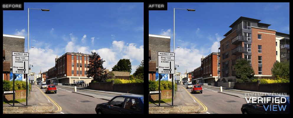
Specialists in creating Architectural Verified Views for planning consent and marketing.
By utilising the latest in 3D computer graphics software and surveying technology, our studio produces photorealistic accurate representations of proposed schemes.
This process is also known as:
Accurate View Representations (AVR)
Verified Images
Verified View Montages (VVM)
With over 10 years experience in Architectural Visualisation our studio provides a highly professional service and industry leading visuals.
Process
1. View Point Photography
High resolution photography of the view points are taken. Camera positions are accurately referenced to the Ordnance Survey Map. Camera height / angle and lens information are recorded.
2. Survey
Survey points are collated digitally from the view point.
3. 3D Software
A 3D model of the proposed development is created from the Architects files and placed within the ordnance survey. The view point is recreated in the virtual space with the surveyed reference points.
The view point photgraphy is placed as a back drop to the virtual camera. The surveyed reference points align to the correct positions on the photography confirming a succesful camera match.
4. Post Production
The view is rendered and overlaid onto the site photography.
Post Production techniques are applied to seamlessly blend the photography and the render computer generated image together.


